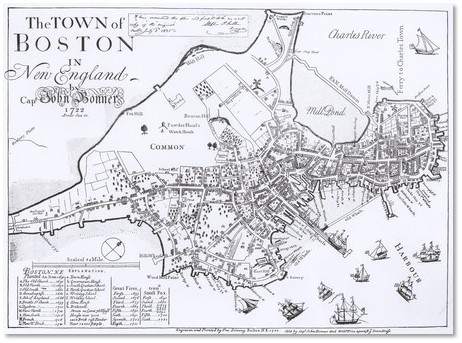
Capt. Bonner Map
Any student of Boston’s history knows that the city’s streets have often had multiple names, which changed and changed again until 1708.
Sometimes the streets themselves disappeared, as happened to many in the old West End. More often, a long street assimilated several shorter names. Occasionally, a street vanished and a new one re-appeared later in another place but with the same name.
Back Street in the North End
This disappearing act happened with Boston’s Back Street. The original Back Street extended through the North End. Laid out in 1666, it ran partially through the land of John Farniseed and went from there “to the cross highway leading to the Burying Ground.” We now call this Charter Street going up to Copp’s Hill Cemetery.
Mr. Farniseed owned the land from Hanover Street to the mill pond near Cross Street, which was divided by a lane that, as was typical of Colonial Boston, had many different monikers. These included: “Street leading from the brick kilns towards Winnissimet Ferry” and “The lane leading toward Mrs. Carwithys house.” From Prince Street east to Charter Street it was known as Green Lane.
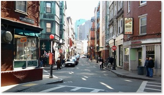
Salem Street today
In 1708, when the city stabilized its street names, Back Street stretched from Prince Street to the bridge but it was called Salem Street from Charter to Prince Street. The name of Salem Street extended over the whole lane in 1824 and today Salem is lined with many of the North End’s famous restaurants and bakeries.
The Return of Back Street
Back Street disappeared from 1824 until the construction of Beacon Street in the 19th century. Beacon Street runs along the dam created to separate the mud flats of the Back Bay from the Charles River. The backs of the houses on its north side looked out on the embankment that ran down from the dam to the river. That meant they also had a desirable river view and fresh breezes.
Between the houses and the river, on the embankment, ran a “poorly kept alleyway behind a line of unsightly sheds and stables” – the new Back Street. The river side of Beacon Street held some of the only stables for Back Bay homes because residents (or, more likely, their servants) could shovel manure directly into the river to be swept away by the tides. The new alley, which runs from Clarendon Street to Charlesgate East, served as an access way to the houses along Beacon Street’s north side for deliveries and removal of waste.
Fighting Off Progress
In 1891, the residents fought off a proposal to widen the embankment north of Beacon Street and build a row of houses between Beacon Street and the river. The city had allocated the proceeds to finance construction of another dam that would maintain water in the Charles River Basin and regulate the ground water. It would keep the ground water in the Back Bay high enough to cover the pilings on which the neighborhood’s structures were built but low enough to prevent cellars and railroad yards from flooding.
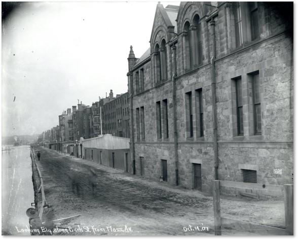
Back Street in 1907 looking east from Massachusetts Ave. at high tide
While the residents won and held on to their cherished river view, they could not hold off progress forever. Initially, this might have appeared to be a victory. The city widened the embankment in 1910 to create the Charles River Esplanade as a public park along the Charles River. In 1951, however, Boston addressed its growing traffic problem by building Storrow Drive as a six-lane parkway with no shoulders and low clearances.
Back Street from Storrow Drive

Back Street today
This second version of Back Street still exists in the same place, although it is no longer poorly kept or lined with stables. Instead it provides rare parking spaces for our horseless transportation and handles trash removal, this time with dumpsters.
You can see it from your car as you drive east along Storrow Drive. Real estate values remain high on Beacon Street and the old alley today has a more carefully groomed appearance.
BTW: /From Storrow Drive you can also see the old seawall, which still stretches along the Back Bay. Just look for the big granite blocks on your right.
Front Street
Front Street had a short life in Boston, existing only from 1804 to 1841, when it became Harrison Avenue.
Before that, however, the earliest portion of the street was known as Rainsford Lane after Edward Rainsford. He came to Boston with John Winthrop in 1630 and chose a house lot on what is now Essex Street. Rainsford Lane went south from Beach Street. It had been renamed Front Street in 1804 and became Harrison Avenue 37 years later.
Developing Boston Neck
In 1801 Boston planned to lay out and lease its lands south of Boston Neck but after four years decided to sell them. These sales went slowly, mostly because of access: only Washington Street connected them with the downtown area. At the same time, when Front Street was being constructed north of the South Boston Bridge, they decided to extend it south of the bridge. Although the city approved this proposal in 1809, it did not follow through on the work, perhaps because of the $50,000 estimated cost. (About $826,203 today.)
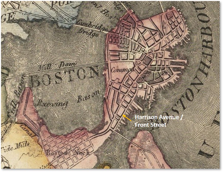
Harrison Avenue / Front Street in the South End
After several additional proposals, in 1869 the city sought once again to improve the lands along Boston Neck and make them more valuable by improving access. They extended two new streets to the Neck Lands—Tremont Street on the west side of Washington and Front Street on the east side. The Front Street Corporation created a dike and filled in five acres of mud flats with more tidal mud dredged from nearby flats.
Today, Harrison Avenue, runs parallel to Washington Street in the South End. A long street, it starts in Chinatown and ends at Warren Street in Roxbury near what is now Nubian Square, known as Dudley Square until 2020. Boston’s street names continue to change and evolve.
The Short and Long of It
So, there we have it: Back Street and Front Street. One is long but has a short history. The other is relatively short but has a longer and more interesting background. You can always go to Salem Street in the North End and toast the old Front Street from one of the excellent restaurants.
More Posts on Boston’s Streets
- Arch Street
- Batterymarch Street
- Canal Street
- Causeway Street
- Derne Street
- Food and Cooking
- LaGrange Street
- Louis Prang Street
- Milk Street
- Sleeper Street
- Sun Court and Moon Street
- Wigglesworth Street
- Winter Street and Summer Street
- Boston Street Names and Political Ego
- How I Started Blogging About Boston’s Streets