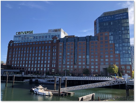
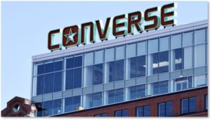
You can’t miss a building this large in any city, but especially in Boston. Seven stories high, five bays wide and 20 bays long, made of solid brick, it has served many purposes and seems to have changed its name with each one. Today, it has its newest incarnation as a corporate headquarters, along with luxury condominiums and restaurants.
A Proliferation of Names
Still, the proliferation of names complicates efforts to research its origins. One book has it listed under one name while another book has a different name. I have counted six. Every time I thought I had it pinned down, another name popped up. It felt like negotiating the traffic in Leverett Circle at rush hour.
There is a reason for this confusion, though. The east and west sections were originally two separate structures. Between 1908 and 1912, Codman and Despradelle probably designed the middle section (which resembles another building they designed nearby for the same owner). Addresses include 160 and 161 North Washington Street and 131 Beverly Street.
For purposes of this post, however, I’m treating it all as one structure because trying to sort out which of the buildings got which name on which date boggles the mind.
Location, Location, Location
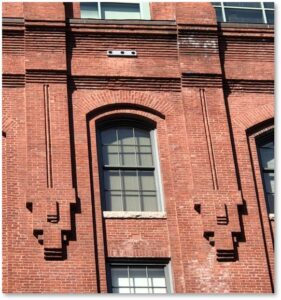
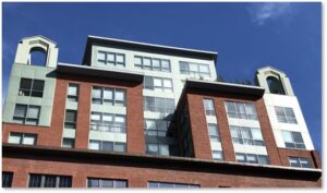
The enormous brick pile lay vacant when I went to college in Boston and I used to look at its architecture—particularly the green arches on the roof—and the decorative brickwork in what I now know is the Panel Brick style on the North Washington Street façade. I wonder why no one was doing anything with such a large and distinctive structure.
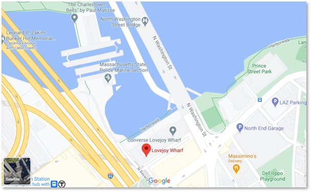
And here’s the interesting part: the building lay between the old Boston Garden and the North Washington Street (Charlestown) Bridge, just steps from the Freedom Trail and the restaurants of the North End. In real estate, the rule is: location, location, location. This building met all three criteria, yet no one seemed to find a way to develop it profitably until now.
Lovejoy Wharf: the Foundation
The Lovejoy Wharf that holds the structure was constructed in 1909. This section north of the Bulfinch Triangle is all made land, created by wharfing out. Someone invested in creating this wharf, but who?
It sat vacant for decades and fell into a dilapidated state. The derelict property was used as a lot to hold overflow parking from events at the Boston Garden. My usually reliable sources held no information on either Lovejoy Wharf, a businessman named Lovejoy who could have built it, or what it was used for. I couldn’t even find a Lovejoy buried in either Mount Auburn Cemetery or Forest Hills Cemetery.
The silence in book after book surprised me. Even the dates vary, with some claiming the building went up before the wharf was built.
Schrafft’s Candy Factory
The brick behemoth rose in several stages, and served as cold storage for the candy company’s ice cream division. It held the candy makers until 1928, when Schrafft’s moved. Although this structure became known as the Schrafft’s Candy Factory, don’t confuse it with the company’s headquarters across the Charles River in Somerville
Submarine Signal Building
The Submarine Signal Company (SSC) was established in in Boston in 1901. It was the first commercial enterprise organized to conduct underwater sound research and to develop equipment to be used for increasing safety of navigation. The company was later acquired by the American Appliance Company (which became a guided missile company Raytheon) in 1945.
Reginald Fessenden, a pioneer of radio technology, worked on an early depth-sounding device, the Fessenden Fathometer, while working for Submarine Signal Company at Nahant (Boston). During World War I, Mr. Fessenden continued experiments in Boston Harbor on underwater communication systems for US Navy submarines. This building housed the Submarine Signal Company.
A plaque on the North Washington Street side commemorates this tenant.
Hoffman Building
Under this name, it held Boston’s Division of Motor Vehicles and the building was refused Landmark Status in 2016.That’s all I found. My searches turned up crickets.
Quincy Cold Storage
Beyond the name, I couldn’t find any information or dates on this occupant beyond an unsubstantiated story. It claims that Joseph P. Kennedy stored either 800 barrels or 800 bottles of whiskey here during Prohibition. You can read the story and decide for yourself whether any of it is true.
Converse Shoe
The building at 160 North Washington St. was designed to be occupied by a single tenant with up to 450 workers. Related Fund Management acquired the site in 2012. Related Beal, along with The Architectural Team, Inc. of Cambridge, then redeveloped it into a 21st century office building that now serves as the headquarters for Converse Shoe.
Established in 1908, Converse is famous for its legendary basketball shoe, the Chuck Taylor All Star sneaker. This footwear is currently being worn on the campaign trail by Vice Presidential Candidate Kamala Harris.
Lovejoy Wharf Today
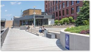
Coming full circle, the new Lovejoy Wharf complex is now a 260,000-square-foot luxury residential building that rose on the 131 Beverly Street site after that building burned and was demolished. The new 15-story building with floor-to-ceiling glass windows was redeveloped by Related Beal. Restaurants have opened on the water side of the building, so you can eat outside by the Charles River.
Lovejoy Wharf extends Boston’s Harborwalk with a new walkway that extends under the Charlestown Bridge. It connects the development’s waterfront park with Paul Revere Park to the north and the Rose Fitzgerald Kennedy Greenway to the south. This completes the Harborwalk’s string of open spaces that stretches from Charlestown to Columbia Point.
You can also walk out the back door and use the Gridley Locks to walk over the Charles River to Cambridge.
So Many Names, So Little Time
So many names in so few years. The whole complex is relatively new for a city founded in 1630. A hundred years, give or take, doesn’t signify. Still, a structure this big can hold a lot of history. I just wish someone had documented it better.
If you have any information on Lovejoy Wharf, the building’s incarnations or photos of it with one of these tenants, please let me know. I would love to write a follow-up post.
