Looking for some new photo ops around the city of Boston? I suggest getting out of the city and into the Seaport — but go all the way to the far east end. Here’s why.
The Seaport: A Commercial Area
 Back in the day, the part of South Boston known as the Seaport District was mainly a commercial area. It featured railroad tracks, piers, wharfs, fish-processing companies, a few roads, and huge wind-swept parking lots.
No one went there unless they (A) worked there; (B) needed a cheap place to park for the day; or (C) were going to eat at Jimmy’s Harborside or Anthony’s Pier 4.
Changing for the Better
That has all changed, dramatically, and for the better. While I would never defend the lack of planning and foresight or the rampant greed that went into developing the current Seaport, it still represents a huge improvement over what was there before.
If you go past the glittering hotels, restaurants, condominiums, and other glass-walled constructions, however, you come to the far east end. This area continues to be mainly commercial and remains far more open. It still has fish-processing businesses, as well as other industrial operations and even blocks of wind-swept parking lots.
Why would you go there?
Photo Opportunities in the Seaport
 Well, the adventurous among us would visit just to see what’s there. Additionally, this area offers some very interesting—and colorful—photo opportunities. That’s especially true in October when the skies are bright blue and colors pop against them.
Because of the area’s industrial focus, photographers will find subject matter similar to that of the paintings of Charles Sheeler but with an Edward Hopper color palette. The patterns and designs are not always obvious when you’re walking down the street, but look closely and you will find them.
Now, I’m not a professional photographer with a big fancy camera. I just have my trusty iPhone. But these photos may give you an idea of the subject matter to be found there. If you are a pro, you will do a much better job.
I intended to write one article on the photo ops you can find at the Seaport’s harbor end. As is often the case, however, I came up with more material than I had anticipated. Thus, here is the first of two articles.
An Active Drydock
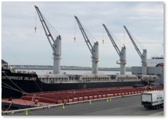
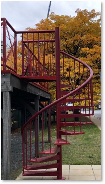 No, this is not the massive one along the Seaport’s Boston Harbor side. This drydock stretches along the north side of Drydock Avenue (of course), which parallels the Innovation and Design Building. If you’re curious and have a good lens on your camera, look for the pocket park at the land end on Tide Street: Brian R. Skerry Memorial Park.
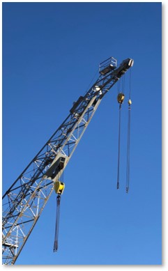
In it you will see a red metal construction that has a ramp at one end and spiral stairs at the other. Climb up and peer over the fence to get a better view of the activity going on in the drydock. This includes big cranes and other equipment that have bright colors and interesting angles.
This active business, owned by North Atlantic Ship Repair, has a 40-foot draft and offers a variety of services. The ships come and go. Some are bigger than others, and the big ones give you a better view because they come closer to Skerry Park.
Four Art Nouveau Silos
The four large concrete towers of Coastal Cement, designed by FMFH, have colorful caps and an office building to match. Robert Campbell, the Boston Globe’s architecture critic of many years, said this about Coastal Cement’s facility:
“It’s a beautiful, bold composition of four tall round silos and one low office that has much of the drama and sculptural power of the great industrial buildings of America’s past.”
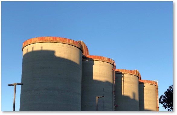 The company uses these silos to store and distribute several types of cement. Red rims cap each one, while half circles and an angular squiggle connect the tops. If the doors are open at the bottom of the silos, you’ll get interesting shapes and shadows.
I just wish Coastal Cement would give those tops a good paint job so they would look as good now as they do on FMFH’s web site. The bright red of the jaunty Art Nouveau silo tops would really shine against the blue sky.
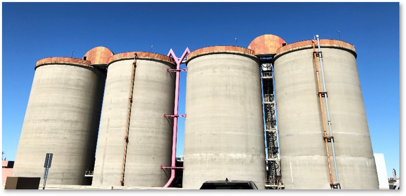 The best location for photographing these structures is Massport’s raised parking deck that is accessed by a steep ramp next door. Do not attempt this during the work week, but on weekends, you’ll have plenty of room. Just don’t park in the spaces reserved for the U.S. Customs agents.
The Drydock Gate
Coastal Cement’s property includes a small waterfront park at the very end of Drydock Avenue. It offers a picnic table or two and benches where you have nice views of Boston Harbor and the sludge digesters at the Deer Island Wastewater Treatment Plant.
You can also get an up-close look at the drydock’s gate, with Boston Harbor’s green water on one side and empty space on the other.
Suggested Photo Ops
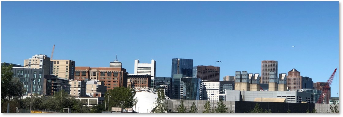
The Boston Skyline: You can get great panoramas of the city from any point along Swordfish Way or Codfish Way. These streets both stretch north from Fid Kennedy Avenue all the way to the harbor.
The Harbor: We are all familiar with the tourist boats that leave from Long Wharf, from Codzilla to the whale watches. But we tend to forget that Boston Harbor is also a working body of water. From the east end of the Seaport, you can get great shots of barges, tugboats, LNG tankers, container ships (more on these in the next post) and other vessels.
Go out to Seaport and sit by the water for a while. You will see all kinds of commercial shipping going in and out. You can also breathe some salt air and take advantage of weekend peace and quiet.
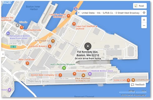
Directions and Parking in the Seaport
The east, or harbor end, of the Seaport currently begins just past Yankee Lobster. This will likely change over the next few months as construction continues unabated, even if it is not reflected on the Boston Business Journal’s CraneWatch Boston map.
 The best time to go and find plenty of parking is on weekends or holidays. If you want to take photos of the cruise ships, however, you have to visit when the ships have docked at the Raymond Flynn Cruiseport. You can find those dates on Massport’s schedule page. The busy season for cruise ships happens in September and October but a few come in during the summer as well.
I have taken photos of many cruise ships over the last few weeks and will add some of those to the next blog post on what you can see along the Reserved Channel.