Now that I have finished my Boston by Foot docent training and passed the final (both written and verbal), it’s time to learn the tour that I have chosen to give: the Victorian Back Bay. Many different tours are offered by @bostonbyfoot and there’s so much to know that learning to do one well before branching out is the wisest course.
I chose the Victorian Back Bay tour for several reasons. The filling of the Back Bay is an engineering marvel that I find fascinating along with the resulting construction requirements for all of the nineteenth-century houses and many of the twentieth-century buildings.
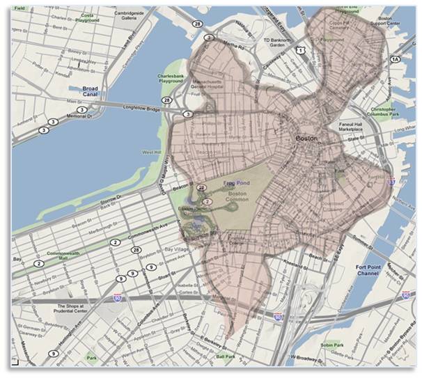
Boston–1630 and Today
The Shawmut Peninsula
When the Puritans landed in 1630, Boston looked very different than it does now. At that time, the Shawmut peninsula was made up of three irregularly shaped lobes at the end of a long, narrow neck. All together, there were no more than 487 acres of habitable land on the peninsula and a fair amount of that was taken up by hills. There was the TriMountain—Beacon Hill, Pemberton Hill, and Mount Vernon—as well as Copp’s Hill and Fort Hill.
A City Built on Made Land
Something had to be done. Something was done. A typical American combination of public need and private enterprise resulted in the Tripartite Indenture, a settlement reached by the City of Boston, the Commonwealth of Massachusetts and the Boston Water Power Company. Signed on December 11, 1856, it enabled the filling of the Back Bay to begin.
Common wisdom says that the Back Bay was filled in with the top of Beacon Hill but that’s not really the case. The TriMountain, including Beacon Hill, was indeed lowered by 60 feet and used as fill in other places but the Back Bay’s New Land was created over 37 years with gravel from Needham, nine miles away.
Important Inventions Created the Back Bay
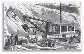
Stationary Steam Shovel
Filling Rail Cars
The project would not have gone far, however, without the fortuitous invention of the steam shovel. These stationary devices loaded up to 35 rail cars—drawn by equally new steam locomotives—in just five minutes.. Trains rolled in to a tipping point in the marsh 24 hours a day, 7 days a week.
The filling proceeded from the Public Garden on the east to the Fenway area and created much more land than is currently included in what is now called the Back Bay neighborhood. When it was done, Boston had grown by 570 acres.
For those who are interested, the definitive book on the land making in Boston is Gaining Ground by Nancy Seasholes, an historian and historical archaeologist. The book is organized geographically and each chapter deals with a specific section of Boston. t’s big, very detailed, packed with information, and illustrated with lots of maps and photographs.
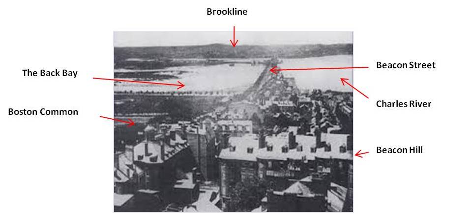
View of the Back Bay from the State House
The Back Bay: A Civil Engineering Marvel
That would be a major project today and even now we recognize the filling of the Back Bay as an engineering marvel and an enormous technological feat. Because the New Land was flat and relatively straight, it had a logical pattern of boulevards and cross streets. The streets are named alphabetically, starting at the Public Garden: Arlington, Berkeley, Clarendon, Dartmouth, Exeter, Fairfield, Gloucester, and Hereford. 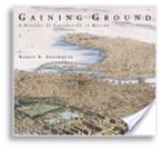 Next came building on the New Land, which was planned as a neighborhood of elegant homes for wealthy Yankees. Unfortunately, the real estate consisted of uncompacted gravel and that’s not a stable base for anything bigger than a shed. How did they do it? More later.